
Today, commercial industries are using drones to capture data that was previously dangerous, difficult, or expensive to obtain. But what is drone data, and what are the real benefits of this new sexy data everyone wants a piece of?
What Exactly is Drone Data?
Drone data often starts as a collection of images (typically hundreds, if not thousands) that were carefully collected according to predetermined specifications of a job or project. These images become the key ingredient for creating actionable business intelligence (or aerial intelligence, as it’s known in the drone industry). But how do we define what makes drone data different? Here is a simple way to better understand it:
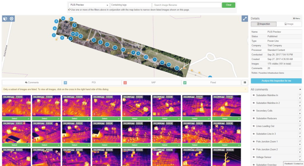
Process. Hundreds or even thousands of images are tagged, identified, arranged, or stitched together to create an organized, usable, and cohesive data set. Drone data is often processed into data products that can be accurately geolocated and measured, such as a map or computer model. Thermal imagery, for instance, enables temperature measurements.
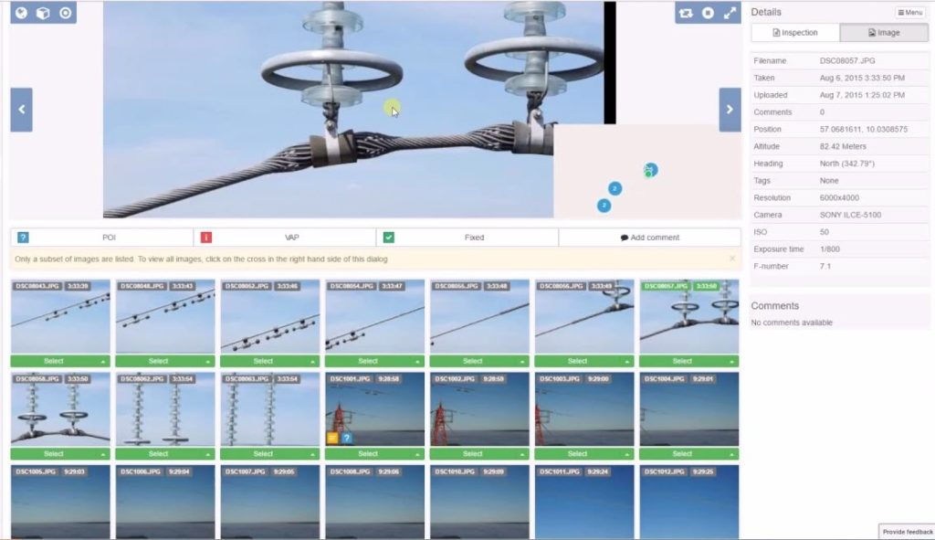
Analyze. With drone data, you can derive insights like classifying the severity of damage on a wind turbine blade, the degree of degradation of insulators, and whether solar panel damage is at the string, module, or sub-module level.
Track. Collecting data over time can show everything from progress on a construction site to the rate of increasing severity of agricultural anomalies or the amount of volume in a stockpile.
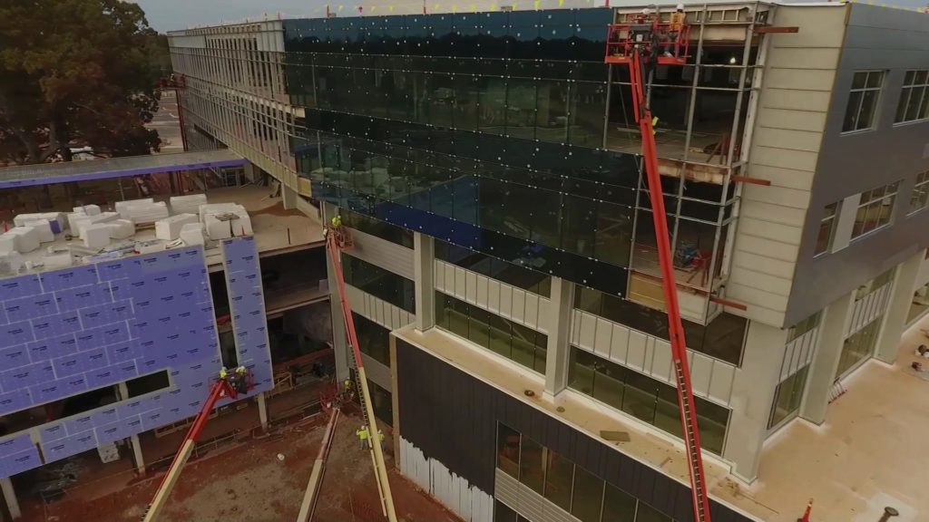
Compare. Stakeholders of multiple energy assets can learn a lot by comparing data sets across their combined sites, with other similar data sets, or against plans. Are turbines from a manufacturer performing better or worse than others? Does our commercial building under construction match the site plan, and are my assets in their right locations?
Predict. Drone data is also driving huge advancements in artificial intelligence and predictive analytics. Instead of scheduling inspections and maintenance according to a common schedule, you’ll be able to optimize based on a more detailed set of site and environmental conditions. Drone data will not only give you insights on your energy and infrastructure assets today but also provide a look into the future.
So how does this data benefit your business?
Drone data improves safety and efficiency
Cell tower companies are starting to recognize that drone programs save tens of thousands of hazardous worker-hours each year. That’s time not spent climbing poles, using bucket trucks, traversing difficult terrain, or being exposed to extreme temperatures. It’s a no-brainer that drones collect data exponentially faster than manual “boots on the ground” collection methods while reducing risks to real people.
Drone data is highly accurate
To test the accuracy of drone inspection data, conduct a simple experiment to validate. Take the results of an inspection by drone, then send out manual inspection crews to run the same inspection on the same assets. You will quickly discover that the drone data accuracy will mirror the ground crew results, but the manual inspection will take days for each site compared to hours with the drone.
Drones provide more points of data in less time
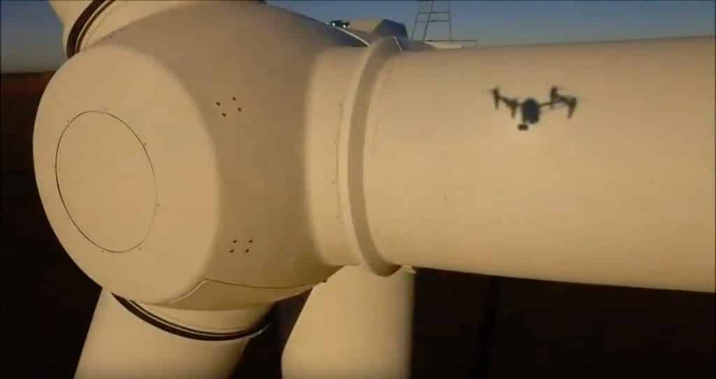
In wind turbine applications, drones can capture close-up, detailed imagery of potential defects that enable maintenance personnel to really see what’s going on. For example, is the apparent damage at the surface level, or is it structural?
Drones can also capture tower, pole, and turbine images from virtually any angle, which is often not possible with other inspection methods. In solar applications, drones spot sub-module defects that manual inspections typically miss.
These improvements help asset managers make better decisions about needed repairs, thus optimizing their maintenance budgets and minimizing downtime.
Drone data can be manipulated for analysis
Unlike manual inspection data, which generally lives in a spreadsheet somewhere, drone data can be manipulated and analyzed from different angles. For example, with a single drone mission, you can get a clear understanding of the shading conditions or vegetation encroachment of a solar farm at any time of the year. During construction, you can overlay actual construction progress imagery with site plans to gauge whether construction is proceeding according to specifications.
Drone data is easily consumable
For data that is processed with a typical inspection (e.g., 300 images or 3GB per project), reading and consuming the information is surprisingly easy. Data can even be delivered through a smartphone app, allowing field maintenance personnel to proceed directly to the location of identified defects.
And finally, drone data lives forever
The most valuable part of drone data is that it is well-documented, organized, and easily stored.
This allows cellular towers, utility sites, construction projects, and renewable energy facilities to perform year-over-year analysis which provides operations the ability to reference prior inspection data to make informed and actionable decisions about future work. Asset managers can even compare the health of equipment across multiple sites.
Documentation is especially relevant where employee turnover is prevalent. In emerging industries such as renewable energy, the employee who performed the inspection in years prior may not still be with the company by the next time an inspection is required. With drone data, you don’t have to reference a person, only a database, to know what the last inspection picked up.

Frank Segarra
Frank Segarra is the Senior Vice President of Sales at Volatus Unmanned Services. He has over 30 years of IT, telecommunications and aviation industry experience and was a US Navy aircraft carrier airman specializing in Avionics Engineering. As a thought leader in drone technology, Frank was invited to be a founding member and co-chair of the CompTIA Drone Advisory Council. and is on the Board of Advisors for the PA Drone Association.


