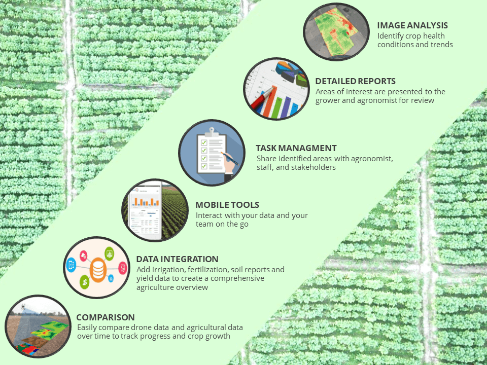
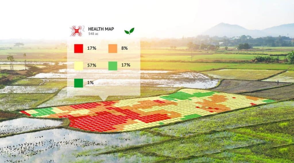
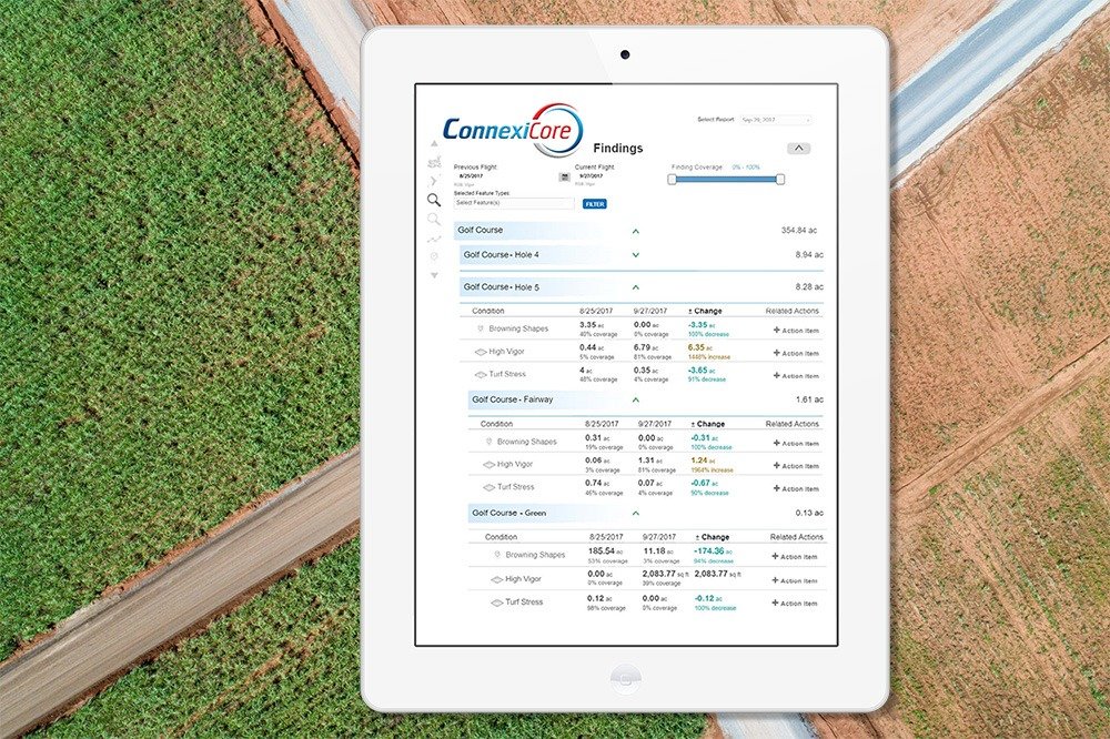
For generations farmers have walked their fields inspecting crops manually for signs of stress, disease, and vigor. Irrigation management, crop inspection, spraying of pesticides, all use traditional labor intensive methods, which are time consuming, and can be difficult as crop canopies thicken. Using Drone technology, farmers can now evaluate their crops at scale, while simultaneously creating vegetation maps that help them manage their crops – and their time – better.
Aerial-based thermal imaging has also become an important tool for agricultural management. It is a non-invasive way to monitor crops, nurseries and greenhouses and even detect plant disease.
Aerial assessments and data gathering within the farming sector provides key information such as:
This information can be used to predict the need for fertilizer inputs, irrigation modifications, peak harvest, overall crop health, and ultimate, crop yield/value. Industrial farmers can now leverage these technologies, since they allow for better business decisions relating to agricultural issues.
ConnexiCore UAV Drones fly to count crops, identify crop stress, and assess yields.
Review analyzed flight imagery and share with your agronomist and staff.
Directly target problem areas, verify ground-truth, and apply treatment as your team determines.
This information can be used to predict the need for fertilizer inputs, irrigation modifications, peak harvest, overall crop health, and ultimate, crop yield/value. Industrial farmers can now leverage these technologies, since they allow for better business decisions relating to agricultural issues.
Review key findings and areas of interest in a comprehensive flight summary report. Compare reports from multiple flights to monitor progress and share improvements with landowners, lenders, insurance providers and more.
See an example of the data and insights we could be generating with less cost, in less time.
Find out what you need to know when hiring a drone service, and learn about creative ways that different industries use drones to improve data, reduce risk, and achieve business objectives.