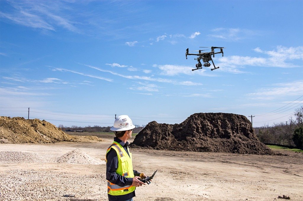
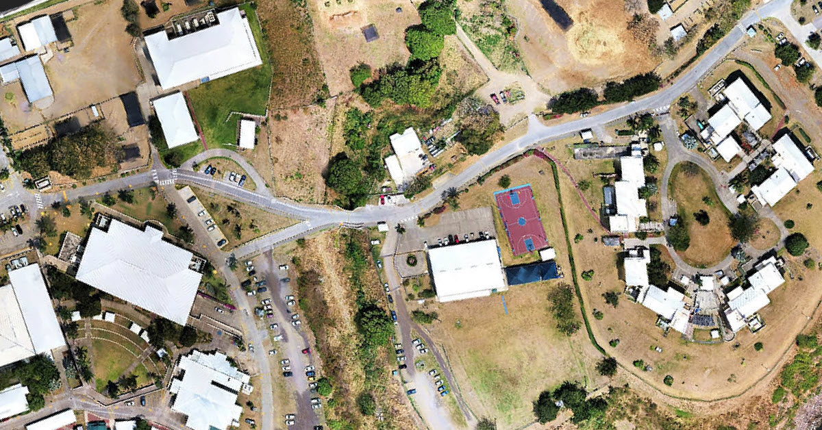
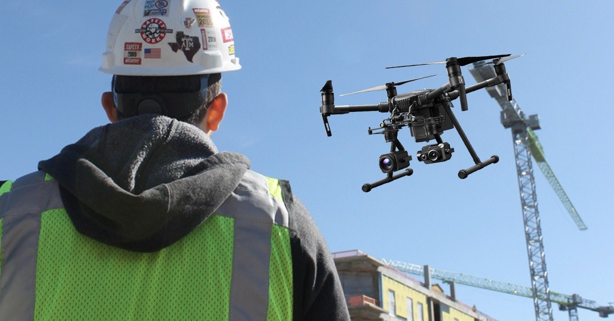
Land developers, property condition assessment, and architectural engineering firms, are using drone technology to decrease project times, reduce overall costs, social distancing and provide timely, detailed, and accurate survey grade results that equal or exceed traditional methods. Regular drone mapping updates keep projects on track and allow for all stakeholders to collaborate in a 3D environment during all development phases. Volatus has demonstrated a commitment to safety and to the creation of high-quality data products for builders, land developers, and general contractors. Some of the key drone use cases in traditional A&E include:
Pre-Construction Documentation (Terrestrial Topology, Vegetation Survey, Contours and Terrain)
Site Preparation (Earthwork, Takeoff, As-Built, Utilities, Elevation)
Site Monitoring (Weekly Geo-referenced Map Updates, Safety Audits, Real-Time Site Plans)
Pre & Post Construction Planning (Slab Pour Areas, ROW, Laydown Tracking, Crane Pick Plan)
ARCHITECTURAL ENGINEERING AND CONSTRUCTION
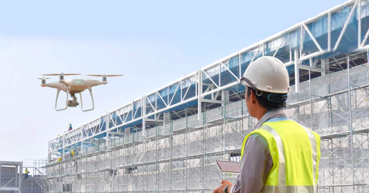
Construction and engineering are industries where UAV drone usage has increased substantially. As a result, it is experiencing mainstream adoption. The amount of time and money saved by deploying drones into a construction project is significant. For companies that run multiple projects at a time, drone solutions integrated into the process are instrumental in helping collect essential information to streamline your project workflow. For the construction industry, drone technology helps to drive decisions and complete tasks more quickly, with lower costs and increased safety. These factors are powerful ways to increase productivity.
Deciding whether adding drones to a project, a business needs to understand and evaluate whether some of the tasks being performed on a construction site could be made easier with a drone.
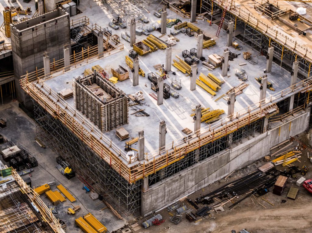
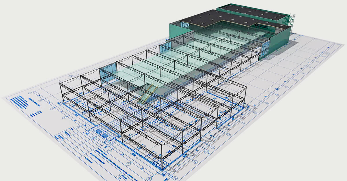
3D MODELING - COMPARING AS-BUILT AGAINST DESIGN BUILD
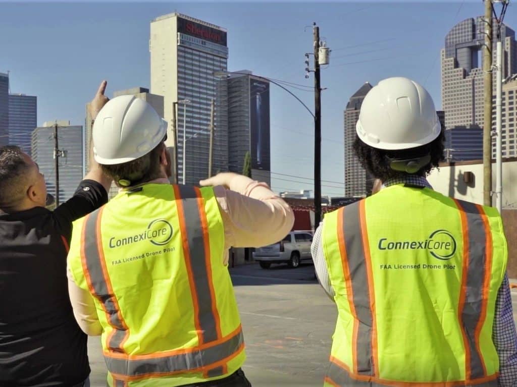
If outsourcing is the answer, Volatus’s national pilot network makes it easier for construction firms to scale across all their projects without being dependent on a few internal certified drone pilots. Volatus works with commercial clients helping insurers inspect structural damage, construction sites monitor progress, mines assess their stockpiles, and more. By leveraging a turn-key drone services providers expertise, it will ultimately contribute to cost savings. DSP’s may be especially useful for unique or one-time projects that would benefit from drone use but may not (yet) be worth investing in a suite of new technology for the construction company to own.
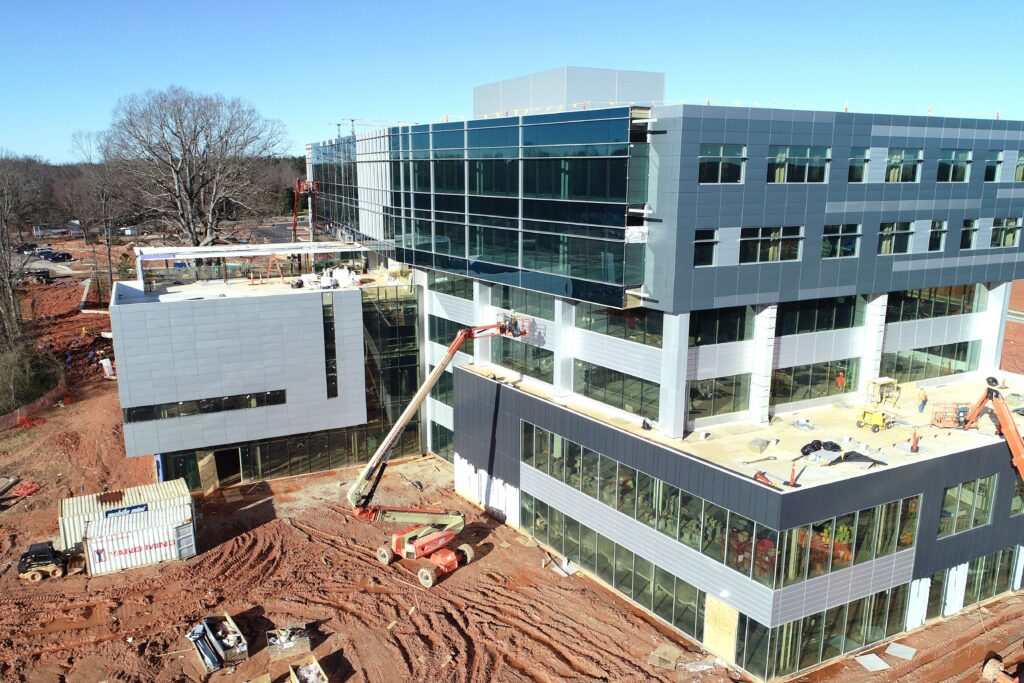
PROJECT DOCUMENTATION & JOB SITE MONITORING PHASE
Many construction firms who have adopted drone technology use them to collect BIM (Building Information Modeling) information to see what the building will look like upon completion. This allows them to identify anomalies on the digital model and address them before they become problems on the physical job site. Drone aerial data collection tools also make it easier to communicate with sub-contractors and clients.
Gain valuable insight into the status of your projects and track progress over time. Recurring aerial imagery can improve safety, logistics and stakeholder updates while integrating seamlessly with your BIM workflows. An important element is that the business of construction is highly complex and involves many skilled workers involved in different phases. Each of these phases can be broken down further into niche tasks, each requiring safety oversight, monitoring, and data collection. The result is a long, expensive, complicated process, with many opportunities for increased efficiency. Track your progress rapidly and repeatedly. Compare against project plan, compare design plans to as-builts.
VALUE OF DRONES THROUGHOUT THE CONSTRUCTION LIFECYCLE
Aerial inspections produce comprehensive data that supports all aspects of planning, compliance, and monitoring in the building design, engineering, and construction phases. Drones provide decision-makers with the ability to easily assess construction sites, track construction progress, and inspect all types of structures and mitigate issues. Drones are serious business in construction planning and management and can be used throughout the entire construction lifecycle, from feasibility and bidding to handover and maintenance.
FEASIBILITY AND BIDDING PHASE
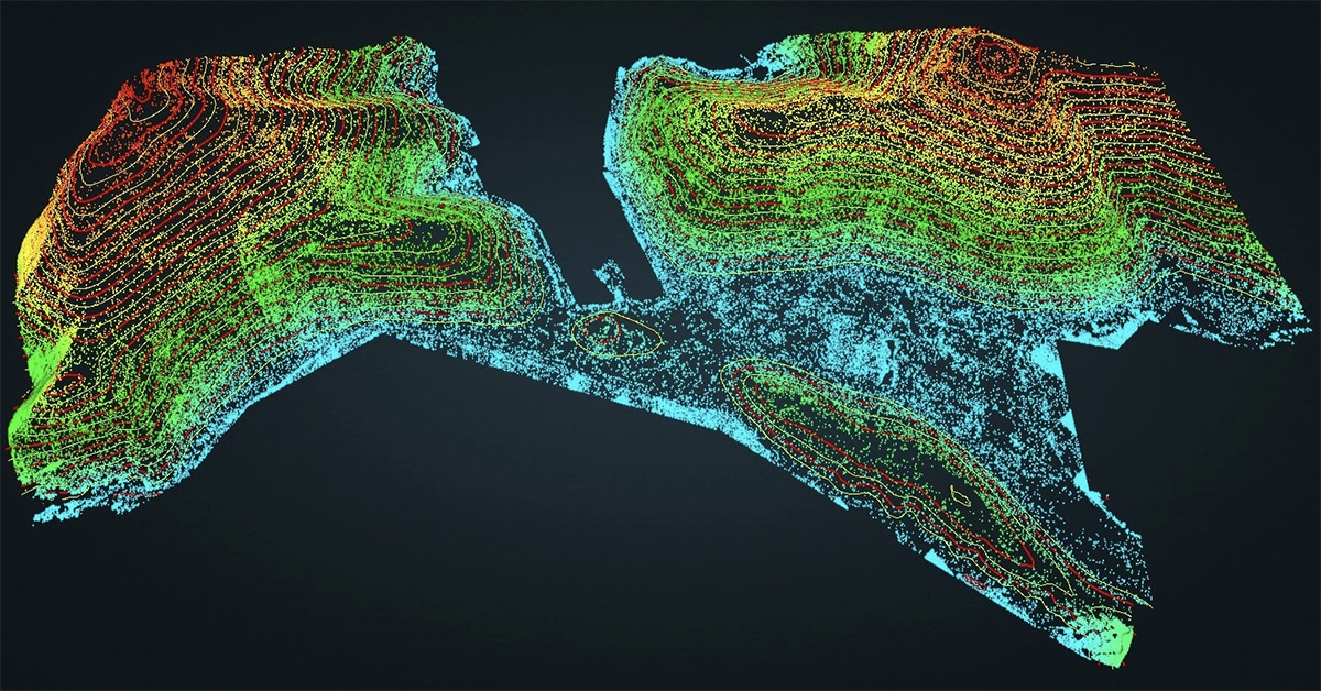
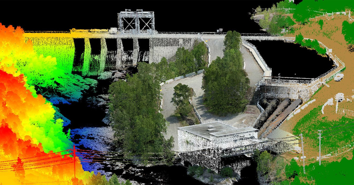
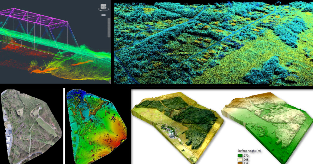
Most drones have a three-axis gimbal and can be mounted with a high-quality zoom lens, advanced optics, and an accurate sensor that’s probably more superior than most smartphones. Aerial data is imported into survey software to create 3D models of existing conditions. This helps with determining feasibility, understanding constructability, and helping owners visualize what the project will look like in the end. It can also be used to identify areas of risk. The planning, surveying, architecture, and engineering that go into shaping what eventually will become a construction project all rely on good data. Using drones to capture images, video, and 3D modeling is only the beginning of the value that they can offer a construction and engineering firm.
DESIGN AND PRE-CONSTRUCTION PHASE
Drone mapping and surveys help inject real-world conditions into design conversations. The ability to easily capture site information also improves the rate at which the design can be iterated on. Getting accurate aerial information on site conditions allows all stakeholders to visualize the scope of the project and foresee any potential challenges. By combining drone data and standard surveying tools, construction firms can offer clients a wider range of services, such as the ability to measure how much cut and fill they will need in order to make the ground level enough to build upon. Or you can generate a 3D rendering of the site, and then create a layer for each stage of building, showing the project progression. Drones are offering the opportunity to provide these services at a more competitive rate, and with the bonus of gathering the data safely.
CONSTRUCTION AND COMPLETION PHASE
During the construction phase, drones have an abundance of potential uses. They help to track and communicate progress, track and manage materials and assets, reduce theft, improve owner visibility, increase safety, and provide valuable information for improving design changes. They also create a valuable documentation trail in case of problems. Imagine your client needs to inspect the steel on the thirteenth floor of a structure. They could hire a crane and send personnel up there, or they could fly a drone and accomplish the same goal cheaper and faster without the risk of having a person working at height, no matter how mitigated that risk might be. As a bonus, a supervisor or engineer on the ground can receive live video footage in real-time, which would not be possible with a human worker.
VIDEO PROGRESSION MONITORING
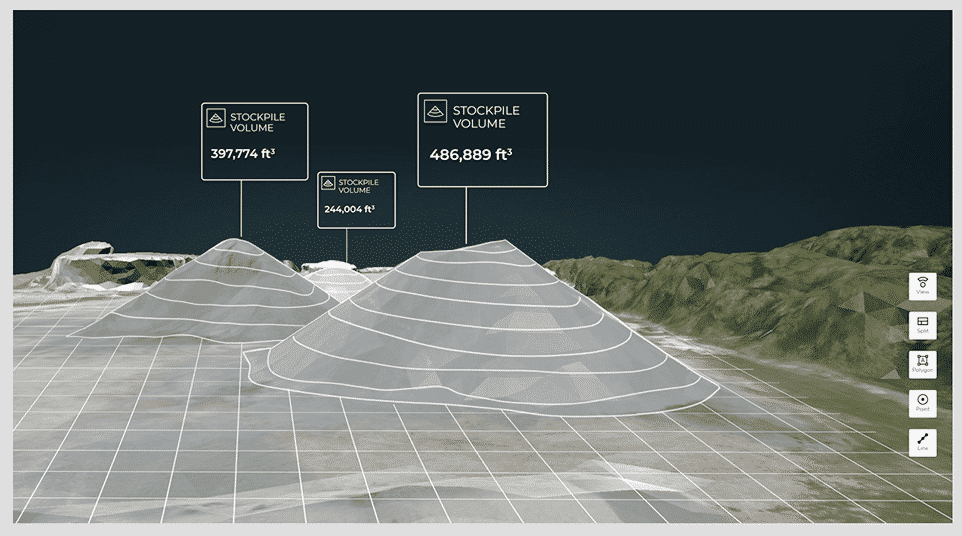
STOCKPILE AND VOLUMETRICS TRACKING
Recurring volumetric analysis can accurately track material usage or project progress and can compare proposed grading plans with true topographic conditions. Measure cut and fill volumes, optimize imported material quantities and cost. With the advanced stockpile analytics, you get greater visibility of your inventory to help you follow up the use of the materials, plan provisioning and more easily attain budgeting goals.
Drones allow you to track your cut & fill quantities easily & accurate. Track your earthmoving phase and ensure compliance with grading plans thanks to the accurate cut and fill feature. Get better control of your earthwork contractors and identify discrepancies over time, while making data-driven change decisions.
HANDOVER AND MAINTENANCE PHASE
Drone imagery and video of the final product unquestionably creates customer satisfaction during handover. This data also has a practical value in property management and maintenance, providing owners and managers with visual data regarding the as-built condition of the building.
At the very heart of unmanned aerial vehicles is the ability to place a sensor—camera or otherwise—in a three-dimensional space with relative ease. Throughout a development’s construction phase (and even before) drone flight paths over and around the site can be made to provide almost real-time visual progress reporting for developers, stakeholders and even the people on site as an engaging record of how the project is going. Up to date and informative visual material can also be produced to evidence key commitments to local authorities or planning agencies such as parks, roads, green spaces or tree protection orders.
MARKETING PHASE
Aerial images and videos for architectural engineering and construction marketing are one of the best-known applications for drones today. Rather than hiring a crane or helicopter, many firms are choosing to utilize drones and the results speak for themselves. With a drone, you can achieve unusual angles, take a greater number of photographs, and achieve results that would otherwise be impractical or impossible. This creates a competitive advantage when it comes to promotional photography and video.
Another great example of using drones for tactical marketing: a drone can take photos showing what the view will look like from any given office – even before that office is built. By pinpointing the position and elevation of space, a drone can fly to those coordinates and snap a picture. This is unrealistic with older technologies and serves to get the wheels of commerce spinning at an earlier stage.