
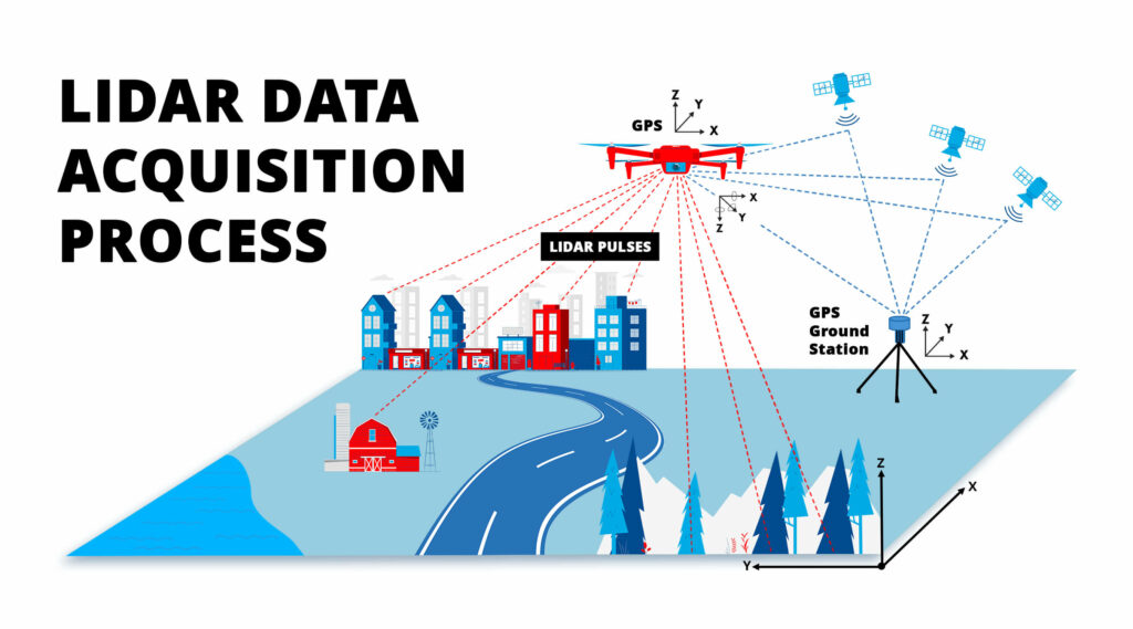
Drones have revolutionized the way many industries collect data. By using lidar or photogrammetry technologies, drones can quickly and accurately capture data that was previously difficult or impossible to obtain. However, the cost of each drone service can vary widely depending on your final objective for the deliverables and the technology used.
Before selecting a drone service for your upcoming project, it is crucial to have an awareness of the intricate technical and pricing aspects of lidar in comparison to photogrammetry for data capture. By understanding the significant factors that impact drone service pricing when utilizing lidar versus photogrammetry, you can make an informed decision and choose the appropriate technology for your needs.
To help with this, Volatus Unmanned Services has prepared a comprehensive guide that sheds light on the cost of lidar and photogrammetry inspections, creating a better understanding for potential clients regarding the anticipated costs associated with these specific types of drone services.
What is LIDAR?
What is photogrammetry?
Photogrammetry is a remote sensing technology used to create 3D models of objects, structures, and landscapes. This process involves taking overlapping photographs of the subject from different angles and then using specialized software to analyze the similarities and differences between these images. By identifying common points and features across the photographs, the software can create a dense point cloud, a large collection of points representing the subject’s surface. From this point cloud, the software can generate a 3D model, which can be used for various applications, including land surveying, construction planning, and archaeology.
The accuracy of photogrammetry depends on factors such as the photographs’ quality, the camera’s resolution, and the calibration of the software used to process the images.
HOW MUCH DO DRONE LIDAR SERVICES COST?
The evolution of drone technology has fundamentally changed how professionals conduct aerial inspections, surveys, and data collection. While aerial videos were the initial draw, new technologies like lidar have transformed drones into powerful remote sensing platforms.
Lidar drones provide high-resolution, accurate data that professionals across various industries use to make informed decisions. However, determining the cost of lidar drone services can be complex, and buyers must be aware of the multiple factors that impact the cost. These factors include the area to be surveyed, the type of lidar sensor required, the data processing and analysis, the experience and expertise of the service provider, and the level of data accuracy needed.
The frequency and duration of flights can also impact the cost, however, discounts may be available for high-volume usage or multiple-day projects, which can significantly reduce these costs.
FACTORS THAT DRIVE UP DRONE SERVICE COST WHEN USING LIDAR VS PHOTOGRAMMETRY
Lidar-equipped drones are more expensive than photogrammetry drones due to the more advanced technology and specialized components required for lidar. Lidar technology uses laser beams to measure distances and create a highly detailed 3D map of the environment. This technology requires a special lidar sensor, which is more expensive than the cameras used in photogrammetry drones. Lidar also requires more processing power and specialized software to analyze the data and create a detailed 3D model. This means lidar-equipped drones typically need more powerful and expensive onboard computers and software.
PRICING AND TECHNICAL ASPECTS
Lidar-Based
Drone Services
- On average, lidar-based drone services can cost between $300 and $1,000 per hour
- Lidar sensors can cost anywhere from $7,000 to $150,000, depending on the level of accuracy required
- Lidar data processing software can cost anywhere from $800 to $10,000 annually
- Lidar data requires more storage space than photogrammetry data, which can also increase costs
Photogrammetry-Based Drone Services
- On average, photogrammetry-based drone services can cost between $150 and $500 per hour
- Photogrammetry software can cost anywhere $500 to $8,000 per year
- The accuracy of photogrammetry data can be affected by factors such as weather and lighting conditions
DRONE PILOT EXPERTISE AND EXPERIENCE
Both lidar and photogrammetry drone missions require a high level of expertise from the drone pilot, but the specific skills required may vary.
For lidar drone missions, the pilot should understand lidar and geospatial technology and its applications. This includes knowledge of how to properly calibrate and operate the lidar sensor, collect and process data, and interpret the resulting 3D point cloud. The pilot should also have experience with mission planning and executing complex flight paths, as lidar data typically requires more precise and systematic data capture than photogrammetry.
DIFFERENT FILE TYPE DELIVERABLES CAN AFFECT LIDAR SERVICES COST
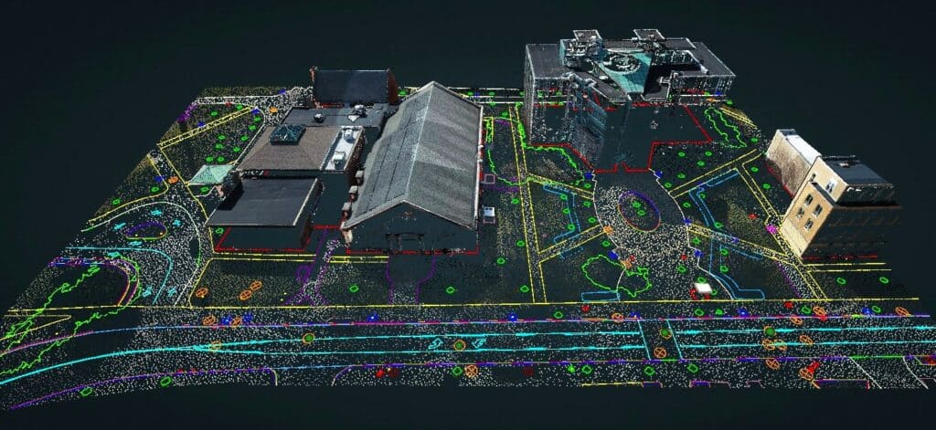
For any successful project, it is crucial to understand the standard deliverables that come with lidar services to ensure the best outcome. For example, with a lidar service provided by Volatus Unmanned Services, you are guaranteed two .las files – one containing all points and the other consisting of classified ground points. These files are essential in creating topographical maps and other data products, however, additional file types may be required depending on the project’s specifications, and producing them may increase the overall cost of the lidar service, whether produced internally or externally.
.DWG files
Contour Lines
Unclassified Point Cloud
Classified Point Cloud
Drone Survey Planimetric and Line Work
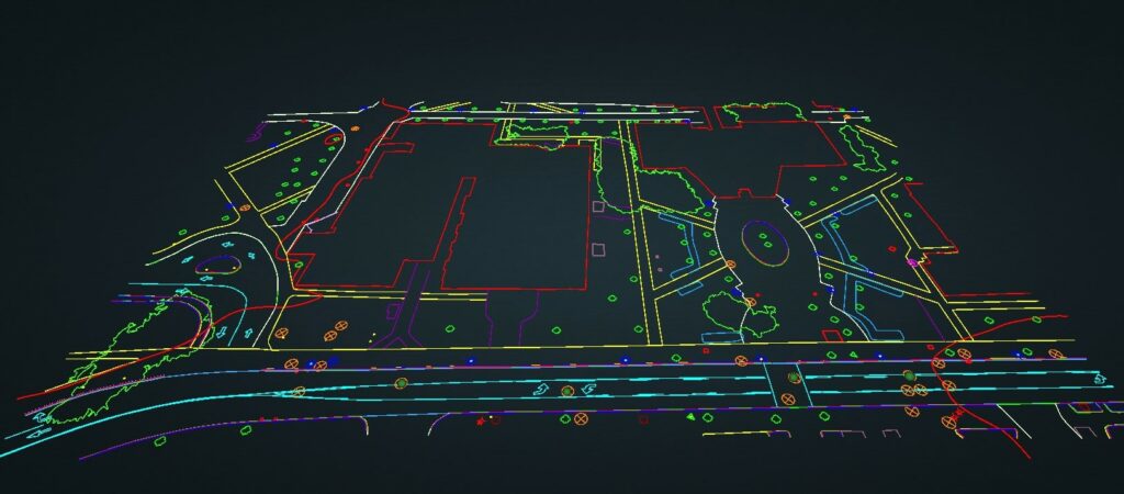
Planimetrics refers to collecting and analyzing data related to the horizontal features of a site, such as the location of buildings, roads, and other structures. Line work involves collecting data on linear features, such as utility lines and drainage channels.
Together, drone survey planimetrics and line work provide architects and other professionals with the detailed data they need to design and plan projects more accurately and efficiently. By leveraging the power of lidar technology and drone surveying, these services can significantly improve the quality and speed of project planning and development.
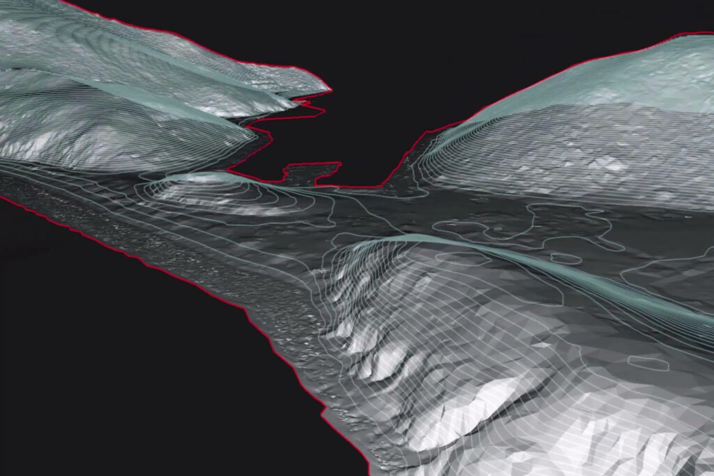
DEM, DTM, & DSM FILES
Digital Elevation Models, Digital Terrain Models, and Digital Surface Models accurately represent the elevation of the true ground.
- DEM – Represents the true ground absent of features like buildings and trees
- DSM – Includes both natural and man-made features of the environment surface
- DTM – Enhanced version of a DEM, which includes vector data of natural features like rivers
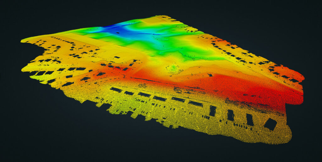
3D MESH
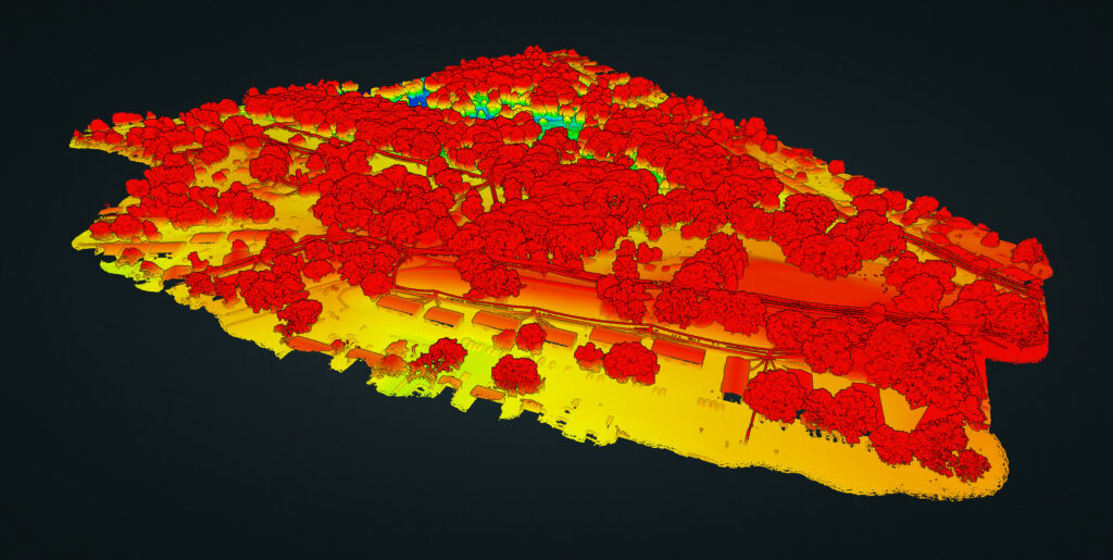
Forestry data
Conclusion
While photogrammetry can be a cost-effective solution for creating detailed 3D models and mapping, lidar provides a more accurate and precise data collection method suitable for various industries, from construction and architecture to forestry and land surveying.
As technology continues to evolve, the potential applications of drone services will only continue to expand. Whether you need to measure the height of trees in a dense forest or create a detailed map of a construction site, drone services can provide the data and insights necessary to make informed decisions and drive business growth.
LET Volatus Unmanned Services HELP DESIGN YOUR NEXT LIDAR DRONE PROJECT
Volatus Unmanned Services, the pioneers of drone services, offers unparalleled expertise in lidar technology. Our team of expert pilots and data specialists are dedicated to delivering the most precise and accurate data to our clients. If you want to take your project to the next level and gain deeper insights into your data, Volatus Unmanned Services lidar drone services are the perfect solution!
With a range of data types available, our team will consult and recommend the best options to achieve maximum business impact. Contact us today for a free quote and discover the power of lidar drone services.


