
Drone Team Deployment
Search and rescue missions are probably one of the most appropriate missions for any public safety drone team. Last week, my volunteer fire department’s drone team received a request to assist another rural area Sheriff’s Office south of Bedford, VA.
The search began for their department/team at 5:30 p.m. and we were requested at 9:59 p.m. Now, with any search, the quicker the resources can make it on scene the more likely the opportunity is for a successful result. At any rate, the Sheriff’s Office requested us at that time, which meant we were performing night operations with our UAS (unmanned aircraft system).
Sizing up the Scene & Airspace
It was a brisk 52-degree night with little to no wind, clear skies and light fog in low lying areas. I would say ideal conditions for our M200 with Zenmuse XT and gambit of batteries. Night operations for a PAO department means we are permitted under our COA to fly at night with strobes for navigation and anti-collision that can be seen at 3 NM (at least).
The parameters for our search were to respond to the house of origin and search the fields around the house, tree lines, creeks, and forests around the residence. My team did express that since the search has been ongoing, that we should expand our search area from the residence out to 1, 5, and 10 miles and work our way back in. Logical thought, but my team was a support function only and the incident commander had other plans.
Tracking the Subject via Drone
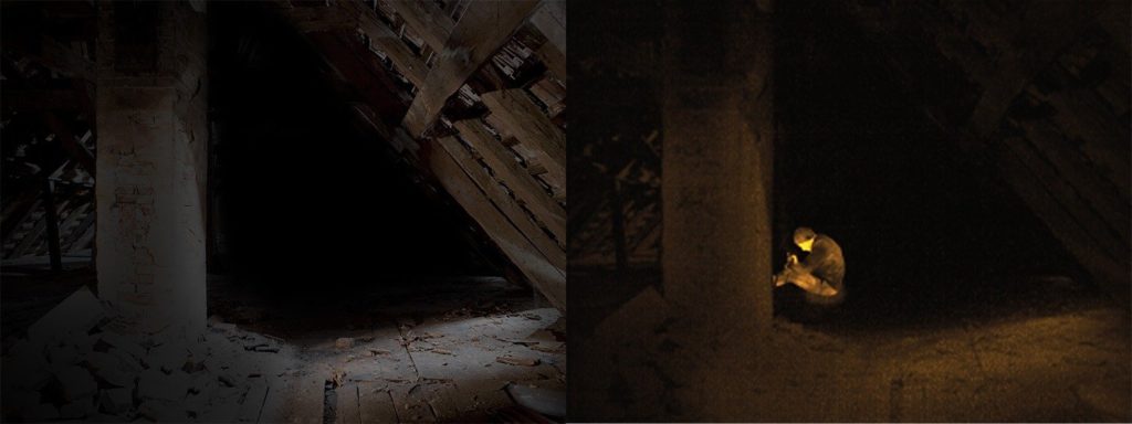
At any rate, we were assigned to first look at a field of interest where the K-9’s had tracked the subject to the creek and footprints were noted in the creek bed heading into a field. Within this field were a small head of cattle (+ 20), a 3-acre pond, and other wildlife. With our assignment given, we set off to find an area that would give us a higher take-off elevation and open from overhead obstructions and low electrical interference possibility.
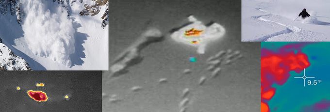
Once we identified our take-off/landing area, I ensured our batteries were set, Compass calibration performed, pre-flight checks performed, and crew brief was complete. “Clear Props” and take-off. We flew towards the field we were assigned and immediately spotted the cattle with Isotherm’s on. Approached the cattle and noticed they all were facing the tree line towards the direction of the house, also towards where the dogs and footprints were noted to be; could we have gotten this lucky this quickly? See for yourself in the video below.
What we found via Thermal Imaging
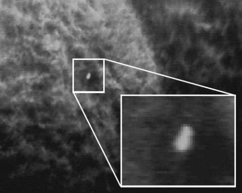
Ultimately, the object you see in the video is a calf. The calf was motionless, and on our 7.85-inch CrystalSky screen looked exactly like a 9-year-old child lying in the fetal position. What did we do?
I advised our Sheriff’s Office liaison to have a team to go to that position while I hovered and double check the area. In my opinion, it was the most appropriate thing to do because I could not with 100% certainty confirm if it was a human or not. However, it took a while for them to traverse the terrain to get to that spot. When I found the object of interest, I was at 60% of battery remaining, I noted the GPS position on my screen and returned to the landing area, swapped batteries, and took-off again to go hover back over the object of interest.
Our goal in Public Safety with events such as this is to pray and hope that we find a child quickly utilizing our skill sets and experience. It is important to remember that our task, in this case, was to point out areas of interest and have that area investigated. I remember saying to my Visual Observer, “Bro, if we found this kid that quickly this is going to be epic!”. We both (at the take-off/landing area) were eagerly waiting and getting impatient at how long it was taking the searchers to get to that point. I tried ascending and descending to get the object to react—to no avail.
Once the searchers got there, and walked over the “hot-spot”, it didn’t move. Wait, what? “It’s right there”, and here is the importance of having a person go search that area – The spot was residual heat from the calf that was lying there. During my return trip to get a new set of batteries and flight back the calf had moved. While the spot was still showing a thermal variant from surrounding areas, it also still looked exactly like a child in the fetal position.
Moral of the story—fly, find, verify, and continue mission. Hope this helps some folks. As always, stay safe, fly safe, perform appropriately.
Questions to Consider for Public Safety Drone Programs
- Do you try to determine the shape, heat signature, human identifying shapes on a 7.85-inch screen?
- Have your teammates looked at the screen with you?
- Is the 7.85-inch screen enough to identify this object?
- How do you manage your operation on the ground?
- Should public safety agencies have a trailer, command vehicle, generator powered unit to maintain batteries, screens, on-scene lighting, etc.?
- How many people does it take to have a successful drone program?
All these questions are valid and should be identified prior to any program beginning, or at least developed as your program begins and matures.

Frank Segarra
Frank Segarra is the Senior Vice President of Sales at Volatus Unmanned Services. He has over 30 years of IT, telecommunications and aviation industry experience and was a US Navy aircraft carrier airman specializing in Avionics Engineering. As a thought leader in drone technology, Frank was invited to be a founding member and co-chair of the CompTIA Drone Advisory Council. and is on the Board of Advisors for the PA Drone Association.


