
Public Safety use of drones after a hurricane
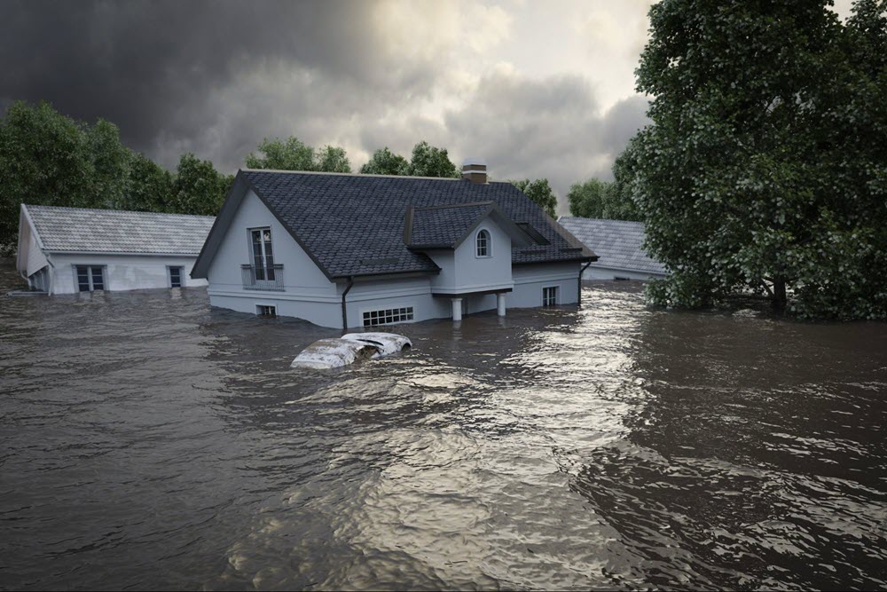
In the wake of Hurricane Florence, information on the physical damage to homes, shorelines, roads, utilities, trees, and coastline infrastructure is still emerging.
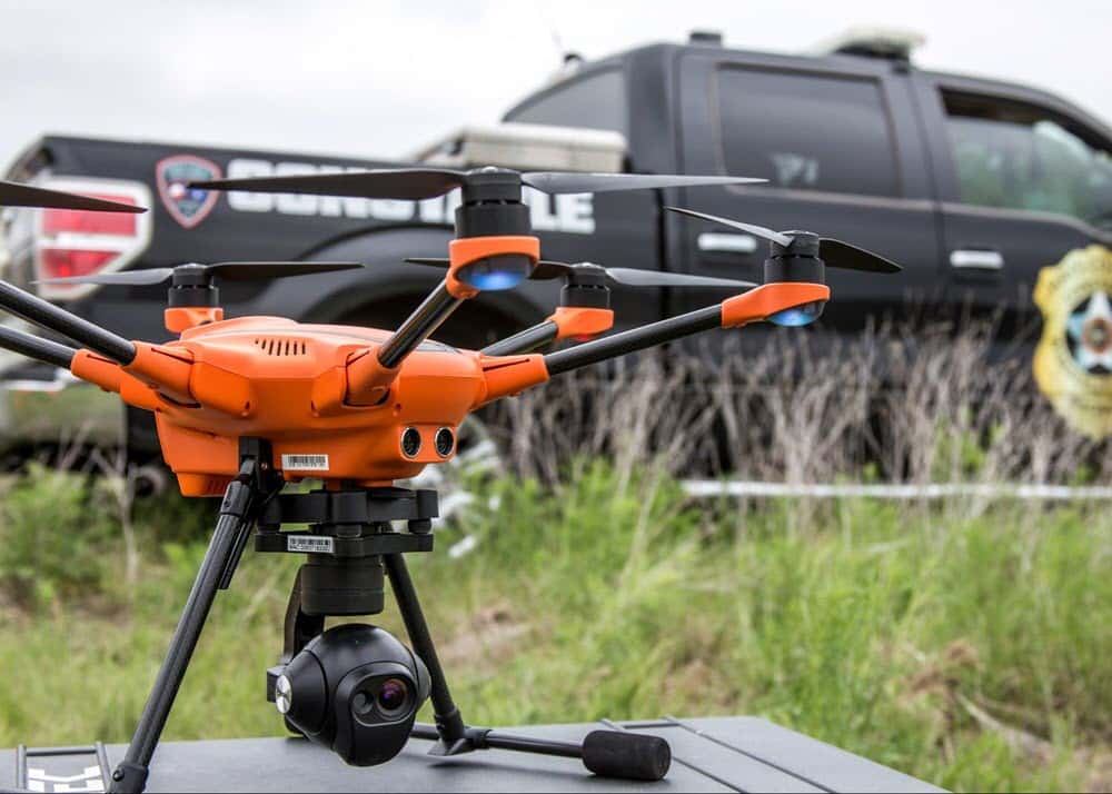
Unmanned aircraft systems (UAS)—also known as “drones”—are beginning to reshape the way public safety officials and emergency responders conduct a post-mortem on disasters. They are an invaluable resource for emergency triage and insurance damage assessment, helping emergency managers and first responders to quickly and safely gather visual aerial data that improves the response and recovery efforts following a disaster.
Many public safety entities are deploying drones in their incident management workflow and for good reasons. Instead of sending people into potentially dangerous situations, drones allow first responders to safely view and assess dangerous incidents from a safe distance. Deployable in under a minute and capable of providing instant video streaming, drones act as a second set of eyes that can be positioned anywhere at a moment’s notice. Monitoring an active situation, finding objects of interest, and gathering time-sensitive data requires speed and accuracy. Vast areas of difficult terrain can be covered in a short amount of time and operations can continue unimpeded through the night.
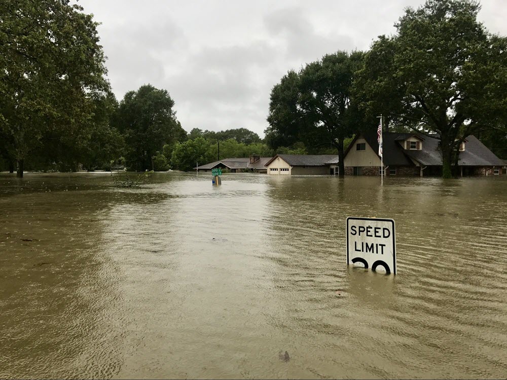
Addressing transportation and evacuation routes, damaged electricity grids, flooded neighborhoods, washed-out roads, and affected industrial sites will form the bulk of the challenges facing local, state and federal authorities in the wake of Hurricane Florence.
Drones help search and rescue
From surveying and mapping disasters to inspections and insurance, drones are the future of search and rescue.
First responders are testing and talking about the benefits of drone use to aid in many types of disaster relief efforts. Drone technology is not going to mean that fewer emergency services personnel are needed, it just means that the way that emergency personnel is used will change.
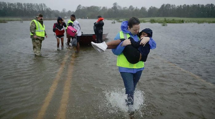
After a hurricane drone teams dramatically accelerate the search for missing people by quickly surveying large areas of land and highlighting thermal signatures and observing critical situations from a safe perspective. They also aid in disaster relief, allowing government and humanitarian organizations to distribute emergency supplies, especially in the absence of viable roads following natural or other disasters.
While flying over ravaged landscapes caused by hurricanes and natural disasters, drones can collect GPS coordinates, real-time video and still images of the damage, helping first responders set priorities back at mission control. This data can be overlaid on area topography and maps using operational intelligence technology to show specifically where and how the landscape has shifted, as is often the case with powerful earthquakes, floods and other natural and manmade disasters that can decimate identifying landmarks.
Analyzing impact to oil and gas refineries
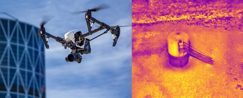
Drones lead the way into hurricane caused environmental disasters by, assessing the scene for safe staging of personnel and equipment. Determine if close is too close and define safe entry and escape corridors. After a hurricane drone surveillance of a refinery can provide eyes from the sky to view placards/signs to determine what chemicals are being transported and visualize noxious gas releases with optical or thermal cameras.
Hazardous gas and volatile organic compounds (VOCs) are extremely harmful to humans. Because of this, scientists have been fixated on improving measures for detection, especially after hurricanes. Drones equipped with cutting-edge sensors, mobile lasers and communication devices, advanced drone technology is designed to reduce exposure to VOCs by accurately detecting the origin of deadly gases. Drones are capable of being deployed autonomously scouting areas on their own, without assistance from a human ground controller.
Drones are also valuable for pre-planning in the event of a natural disaster or catastrophe. Let’s say there is a hazardous material tower or an oil refinery carrying 2,000 gallons of diesel fuel. Using drone mapping in combination with thermographic imaging, you can create a digital surface model to help determine if the diesel will eventually flow into the water aquifers in case of a leakage. Hazmat teams can take necessary precautions to prevent the same.
Drones for insurance claims
When a disaster like a hurricane causes property destruction, there is likely to be lots of claims on insurance. This is under the presumption that most people, especially those living in areas which are at increased risk of hurricanes, will have home insurance. The insurance companies are pressed to work quickly, assessing the damage so people can begin to rebuild their lives as soon as possible. Each day a claim is put on hold because of backlogs is another day a company must pay for downtime, such as business interruption costs and additional living expenses. After a disaster such as Hurricane Florence, it is often difficult for claims adjusters to navigate residential neighborhoods that are now unrecognizable and even dangerous.
Drones are being used to assess damage, especially by insurance companies. Allstate and Farmers Insurance use their own company drones to make assessments. It speeds up the process so insurance companies can pay claims to customers much faster than they normally would with multiple-person crews scoping out the extent of losses.
With information on-hand about catastrophes, analysts and engineers create better disaster response models by providing accurate information to response teams, allowing for more adept, on-time relief efforts. Drones, with near-artificial intelligence, can provide a unique perspective and review extensive information for a disaster claim.
Used as a complementary tool, drones can provide a large amount of information for a variety of incidents. When a site isn’t accessible by ground immediately after a hurricane, or other disaster, drones give insurance adjusters the access they need without compromising safety.
Even when a site is accessible, drones provide a far safer way to conduct thorough inspections, reducing the need to navigate rubble or scale rooftops. High-resolution drone maps offer a complete aerial view gathered at a safe distance. Drones are not only faster, safer, and more accessible than ground or dangerous and expensive helicopter inspections, they give insurance adjusters a far greater rich set of data, which can be leveraged throughout the claims process.
Drone technology enables faster claims processing, a reduction in loss adjustment expenses and improved claims adjuster safety. With natural disasters such as hurricanes, careful planning and the fast reactions enabled by that planning are critical to safe first response and a fast claims process, all of which speeds up the rebuilding process. The insurance industry is ready for drone technology because it does just that: it enables faster claims processing, a reduction in loss adjustment expenses and improved claims adjuster safety.
The first significant use of drones in the insurance industry was in response to super storms last year, after Hurricane Irma in Florida and the Caribbean and Hurricane Harvey in Texas. Both storms resulted in major loss of property and life.
How exactly does drone technology aid insurance companies in storm recovery?
Drones enable pre-planning so that disaster response can be faster. Pre-staging is often done in advance of hurricanes. Insurers can train drone operators before the storm hits, as well as stage drones with local teams ahead of time so that they are prepared to respond as soon as conditions have improved. Effective planning is the best way to ensure seamless, fast response.
Drones are also able to perform site surveys much faster than traditional methods (which involve sending claims adjusters up on roofs with ladders). With a drone, inspection can be done in just 10 to 15 minutes, speeding the way to processing. Drones reduce loss adjustment expenses by gathering unbiased condition data quickly, reducing and even eliminating the need for third-party vendors to provide costly ladder assists or perform roof inspections.
Insurers will be able to differentiate from the competition by reducing their claim cycle times as much as 80%, keeping their clients happy. Taken together, better planning, faster and more efficient inspections, and reduced third-party costs all mean that property owners will rebuild as soon as possible after a storm.
Energy and utilities grid assessment
One of the crucial ways drones are helpful in the wake of a hurricane is in getting the electrical grid up and running again in areas crews cannot access, either because the surrounding spaces are flooded, or power lines are down.
Dozens of drone teams were recruited to help with Hurricane Florence energy and utilities damage assessment and coordinating utility recovery efforts. The numbers may seem small compared with the roughly 40,000 utility workers mobilize to aid, but drones can provide faster access to find problems in flooded or otherwise dangerous areas. Local energy providers are deploying aerial equipment fitted with infrared and high-zoom sensors that can inspect substations, locate malfunctioning solar panels and even help to restring power lines.
Days after Hurricane Harvey’s wind, rain, and floodwaters overtook Houston, drone service providers, authorized by the Federal Aviation Administration and contracted to conduct storm damage assessment with insurance and utility companies, started inspecting homes, electrical lines, and gas and oil refineries to document damage. When Hurricane Irma roared across the Keys in 2017, it created one of the many unique access challenges for utility crews who were crucial to getting the lights back on after 2017’s monster storms. Once the winds died down, inspectors had to ensure the safety of each bridge segment before power crews were allowed in, leaving tens of thousands of residents waiting in the dark for days, enter the new wave of utility drone technology. Drone technology enables crews to survey infrastructure damage and coordinate their responses well before they can physically access the damage left by the hurricane.
The future of drones in hurricane response
When it comes to assessing damage and spotting people in distress, drones may be hard to beat. In years to come, drones will take on an increasingly important role in natural disaster response, search and rescue, firefighting and other disaster management activities, reducing the risk to human life during operations, and limiting damage to assets by enabling first responders to work proactively, rather than reactively. It is the job of the people to help those affected by natural disasters to recover from their ordeal and crowdfunding via GoFundMe is the most effective way of doing so. But it is the job of the drones to help those people to survive their ordeal in the first place by being such an important part of natural distance response.
Drones can perform critical tasks as disasters unfold, including spotting people in need of urgent help. Evidence suggests drones may have certain advantages over traditional search-and-rescue efforts — including speed. Drones can also deliver rescue ropes and life jackets in areas that are too dangerous for ground-based rescuers to venture into. Drones are also providing help in the aftermath of disasters — for example, to assess damage to buildings, roads and bridges, and power lines. In addition to spotting people in need of help and assessing flood damage, drones are used to monitor levees, predict further flooding, and help provide estimates of how long certain areas would be underwater.

Frank Segarra
Frank Segarra is the Senior Vice President of Sales at Volatus Unmanned Services. He has over 30 years of IT, telecommunications and aviation industry experience and was a US Navy aircraft carrier airman specializing in Avionics Engineering. As a thought leader in drone technology, Frank was invited to be a founding member and co-chair of the CompTIA Drone Advisory Council. and is on the Board of Advisors for the PA Drone Association.


