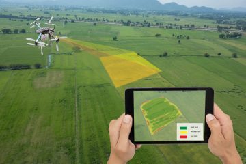
ConnexiCore provides on-demand and project-based commercial drone flight services nationwide to virtually endless industries. With our deep network of 1000+ (FAA) licensed pilots, GIS engineers, and photogrammetry experts across the United States, ConnexiCore can be a valued partner for customers interested in leveraging drone aerial data collection technology.
Our turnkey approach offers our clients the highest value beginning with, building out the mission, piloting the drones, analyzing the data, extracting insights from that data, and delivering measurable and actionable tasks to support decision making. While capturing aerial data is only part of the process, the real challenge is harnessing all this information so that it is consumable, shareable, and actionable.
Most of our drone services include a completely automated workflow as most projects are autonomous with pre-defined missions and applications to collect aerial data. Our drone flight services include a variety of geospatial expertise including; aerial data collection, film quality image & videography, drone live video streaming, and aerial mapping. ConnexiCore carries a $10M insurance policy for our fleet and most pilots are OSHA-10 certified.
You can provide initial information about your project through our online contact form. Simply enter your contact information so we have a way to reach you then briefly describe your project. ConnexiCore will follow up with either an email or phone call to better understand your project and what you’re looking for. Often our experts will collaborate with our clients and suggest different options or approaches to increase the efficiency of your project.
Part of being good stewards of federal regulations and commercial drone laws, ConnexiCore will always verify your project meets FAA drone regulations and guidelines. All our projects utilize the right drone for the application with cutting edge technology for exceptional images and video.
We also offer professional image and video editing to enhance your photos or turn your raw drone footage into a professionally edited video.