
Understanding Drone Technology: How Drones Revolutionize T&D Inspections and Asset Analysis

The synergy of drones and expertly outsourced data analysis is emerging as a potent solution for T&D inspections and asset analysis.
Safety Innovations: Using Drones for Confined Space Inspections
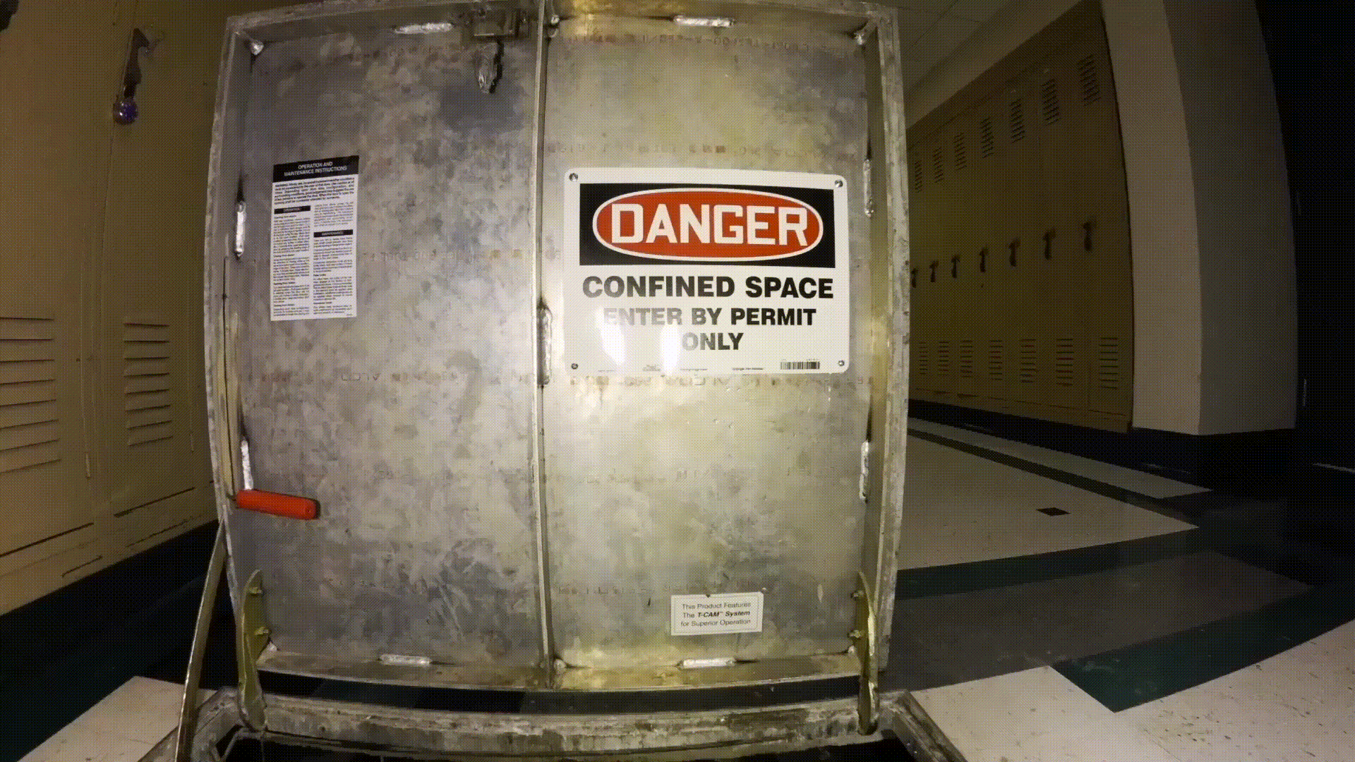
In an era of technology revolutionizing our approach to old problems, safety in confined spaces remains a critical challenge. From complex industrial tanks to tunnel systems and pipelines, confined space inspections have historically been dangerous, expensive, and time-consuming. However, we are now entering a transformative moment. Imagine a world where confined space inspections are carried […]
Drone Video Camera Movements: Understanding the Basic Techniques to Elevate Your Aerial Storytelling
Telling a compelling aerial story requires more than just modern drone equipment. It requires careful planning and execution to ensure that each camera movement intentionally captures footage that ultimately creates a memorable experience for the viewer.
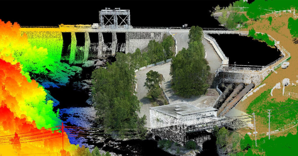
Lidar vs. Photogrammetry: Understanding Pricing and Technical Variances of Drone Inspection Services
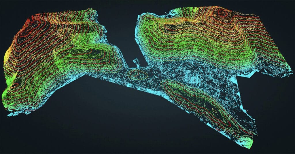
While photogrammetry can be a cost-effective solution for creating detailed 3D models and mapping, lidar provides a more accurate and precise data collection method suitable for various industries, from construction and architecture to forestry and land surveying.
Drone Cinematography: How Technology Has Changed the Way We See the World
Drones have revolutionized the way we capture aerial footage for cinematography. With advancements in technology, drones have become more affordable and accessible, allowing filmmakers and businesses to capture stunning cinematic footage that was once only possible with expensive helicopters, camera rigs, and large production crews.
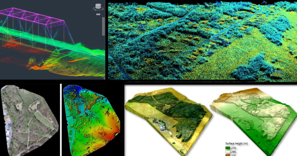
Drone Lidar and The Use Case for Forestry
Lidar technology provides data with high spatial resolution and vertical accuracy, creating opportunities for enhanced forest monitoring and management.
Using Drone Mapping In the Construction and Engineering Industry
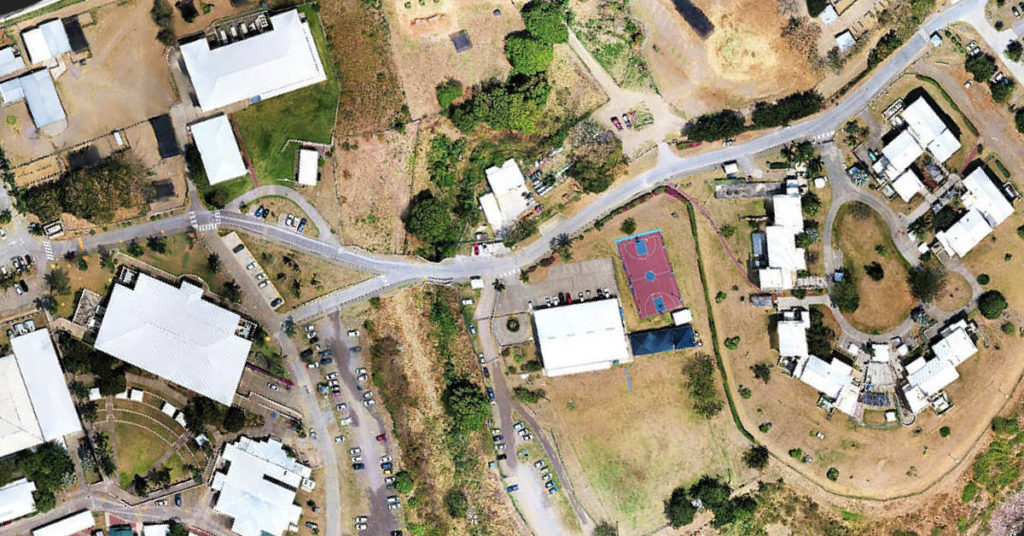
Most commercial construction sites are typically locations for future warehouses, retail facilities, commercial real estate, manufacturing plants, business offices, etc. Engineering firms are now able to identify potentially unforeseen hazards and plan more effectively by using drone mapping technology to track site progress.
Volatus Aerospace Acquires ConnexiCore to Expand Drone Services Business into the US
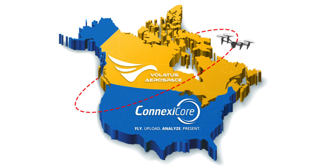
The acquisition will create the largest and most comprehensive drone services provider in North America, with a pilot network blanketing Canada and the United States.
Insights From Six Years In The Drone Business

It is important to acknowledge that I feel so blessed, grateful, and humbled to have worked with drones and all the interesting people I have met over the last six years who have helped push the drone industry forward.
It’s Not About the Drone… It’s About the Data
| For the last 6 years or so the world has witnessed how incredible drone camera technology has generated super-high-resolution images and stunning aerial video in 4K resolution and captured at up to 60 frames per second quality. These two data types have catapulted the drone industry initially in Real Estate and aerial cinematography. Drones […]


