
Lidar vs. Photogrammetry: Understanding Pricing and Technical Variances of Drone Inspection Services
While photogrammetry can be a cost-effective solution for creating detailed 3D models and mapping, lidar provides a more accurate and precise data collection method suitable for various industries, from construction and architecture to forestry and land surveying.
Drone Lidar and The Use Case for Forestry
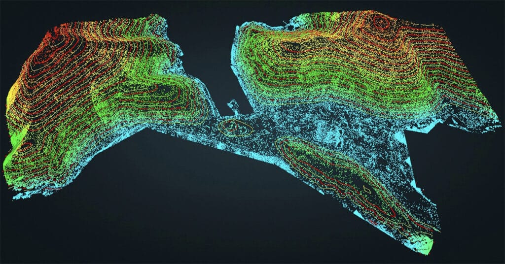
Lidar technology provides data with high spatial resolution and vertical accuracy, creating opportunities for enhanced forest monitoring and management.
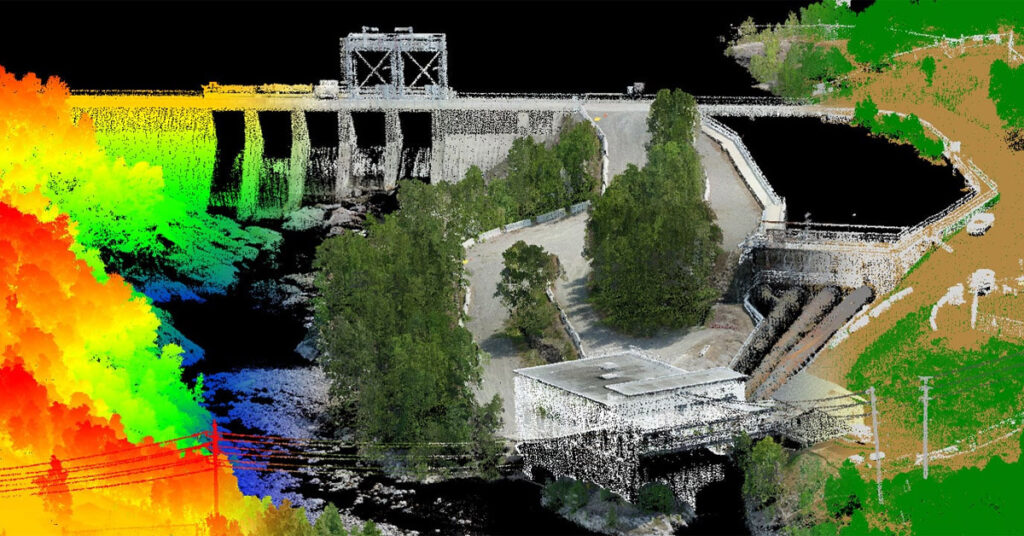
Capturing Drone Data Using Lidar Technology

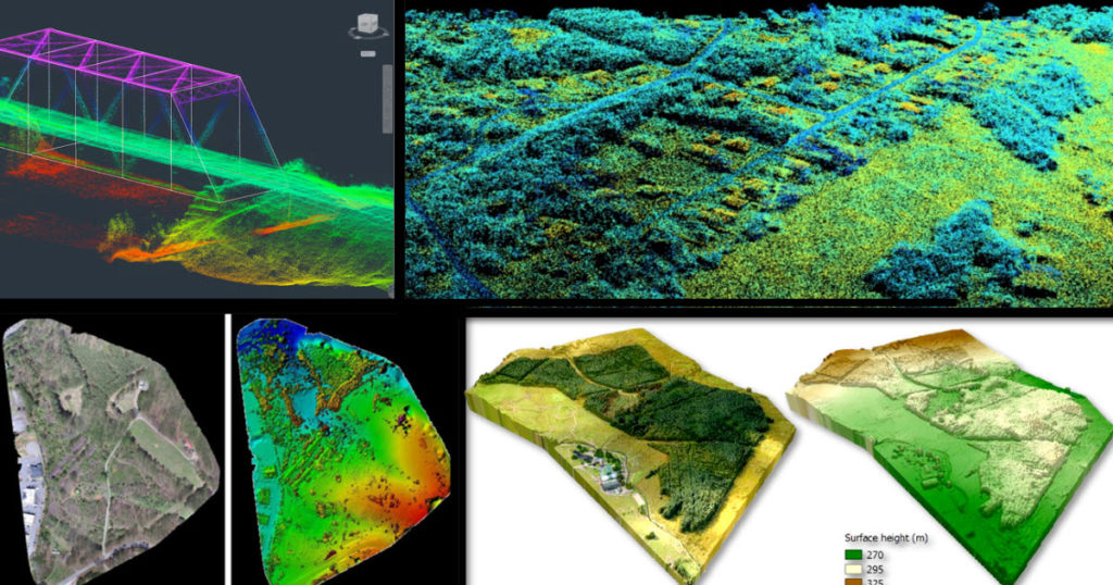
Maude Pelletier describes elements of lidar technology, compares and contrasts lidar with photogrammetry, discusses strategies for creating point clouds, and explores typical use cases.
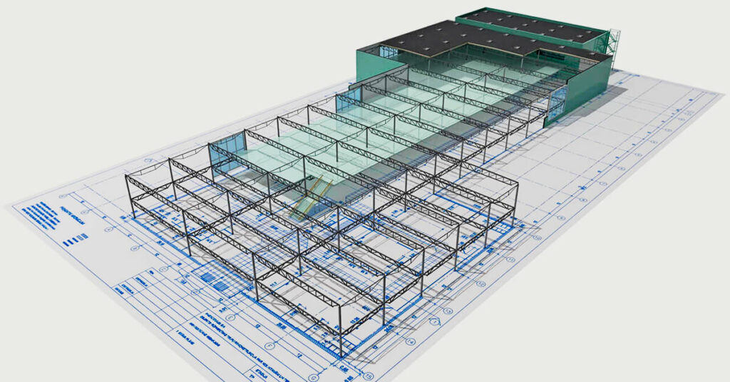
Using Drone Mapping In the Construction and Engineering Industry
Most commercial construction sites are typically locations for future warehouses, retail facilities, commercial real estate, manufacturing plants, business offices, etc. Engineering firms are now able to identify potentially unforeseen hazards and plan more effectively by using drone mapping technology to track site progress.
It’s Not About the Drone… It’s About the Data
| For the last 6 years or so the world has witnessed how incredible drone camera technology has generated super-high-resolution images and stunning aerial video in 4K resolution and captured at up to 60 frames per second quality. These two data types have catapulted the drone industry initially in Real Estate and aerial cinematography. Drones […]
Using Drones During The Feasibility And Bidding Phase Of Construction
How drones benefit the construction process Using a drone as a tool, large complex construction projects immediately benefit from 3D and photogrammetry data. From estimating, to pre-construction, to construction progress, contractors can use assets such as RGB and thermal imaging to capture a wide range of information useful for inspections or construction documentation. With many […]
The Next Evolution Of UAS Drone Technology: Future Ideal Or Present Necessity?
As I have pontificated in nearly every blog, article, interview or webinar I have been a part of I have to keep up with my tradition and reiterate… unmanned aerial system (UAS) technology is advancing faster than commercial business stakeholders can keep up with. That isn’t anything new these days considering Goldman Sachs has projected […]
WEBINAR VIDEO: Using Drones For Remote Construction Project Tracking In Real-Time
WEBINAR VIDEO: Using Drones For Remote Construction Project Tracking In Real-Time Frank Segarra | March 28, 2019 Webinar Overview Design/Build AEC firms are under mounting pressure to deliver quality construction projects under tight budgets and timelines. While drone technology offers interesting possibilities, real benefits are achieved when you add relevant data to UAV photos and […]
How Construction Companies Use Drones
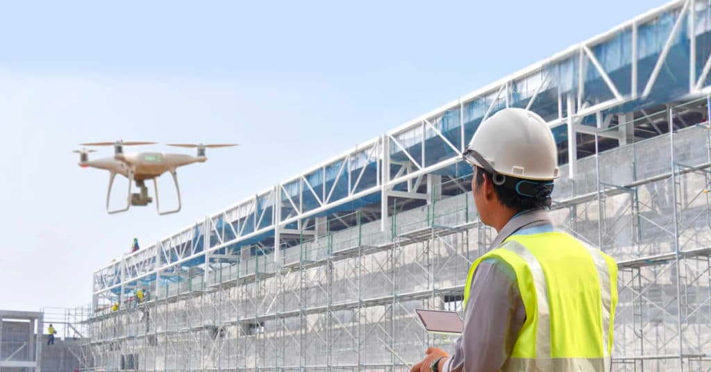
Small Unmanned Aerial Vehicles (sUAV’s)—more commonly known as “drones”—are one of the fastest growing technology applications for construction in decades. While aerial progress monitoring and inspection assessments are the predominant uses today, there are hundreds of emerging applications leading to safer job sites, better dissemination of information, and in many cases, more accurate and precise […]


